

Lili's Philly
Explaining cognitive mapping through an exercise with the Broad Street Run route

Cognitive mapping within the subfield of community and urban sociology is a methodology that elicits perceptions of place and constructions of space by participants. By offering an existing base-map of the area under investigation (like Rengert and Pelfrey (1997) do in their study of city residents’ perceptions of dangerous places within the city) or asking respondents to draw a free-hand map (like Hwang (2016) does in her study of residents in a gentrifying neighborhood to learn how they define their local context), researchers can encourage participants to share rich data on their subjective construction of the physical, social, and symbolic boundaries of a certain area.
I incorporated this method into my the interview study of prosecutors who worked on cases involving juveniles or young adults that ultimately became my Qualifying Paper (aka Master’s Thesis). The original goal of that study was to understand how, if at all, place impacts prosecutors’ discretion on charging, sentencing recommendations, or plea deals for cases involving juveniles or emerging adults (18-24). Because the work of a prosecutor is so spatially situated within the local context of the District Attorney’s office’s purview, I knew I needed to understand the individual prosecutor’s lay of the land. I started each interview with a cognitive mapping exercise: I used a simple base-map that included the water and land boundaries – but lacked any names of neighborhoods or prominent landmarks — of the county in which they worked. I asked participants to label the map, showing me where different neighborhoods were located and telling me about them as we moved through the county. The goal of this exercise was to get an initial sense of how the participant conceived of their jurisdiction and to resituate the participant with the county context in which they practiced, given that most were no longer working for the District Attorney’s office at the time of the interview. The map then served as a useful tool within the rest of the interview to return to for specificity in their recounting, keeping us both grounded in the participant’s understanding of the local and geographically-specific nature of their work.
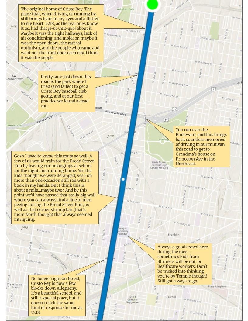
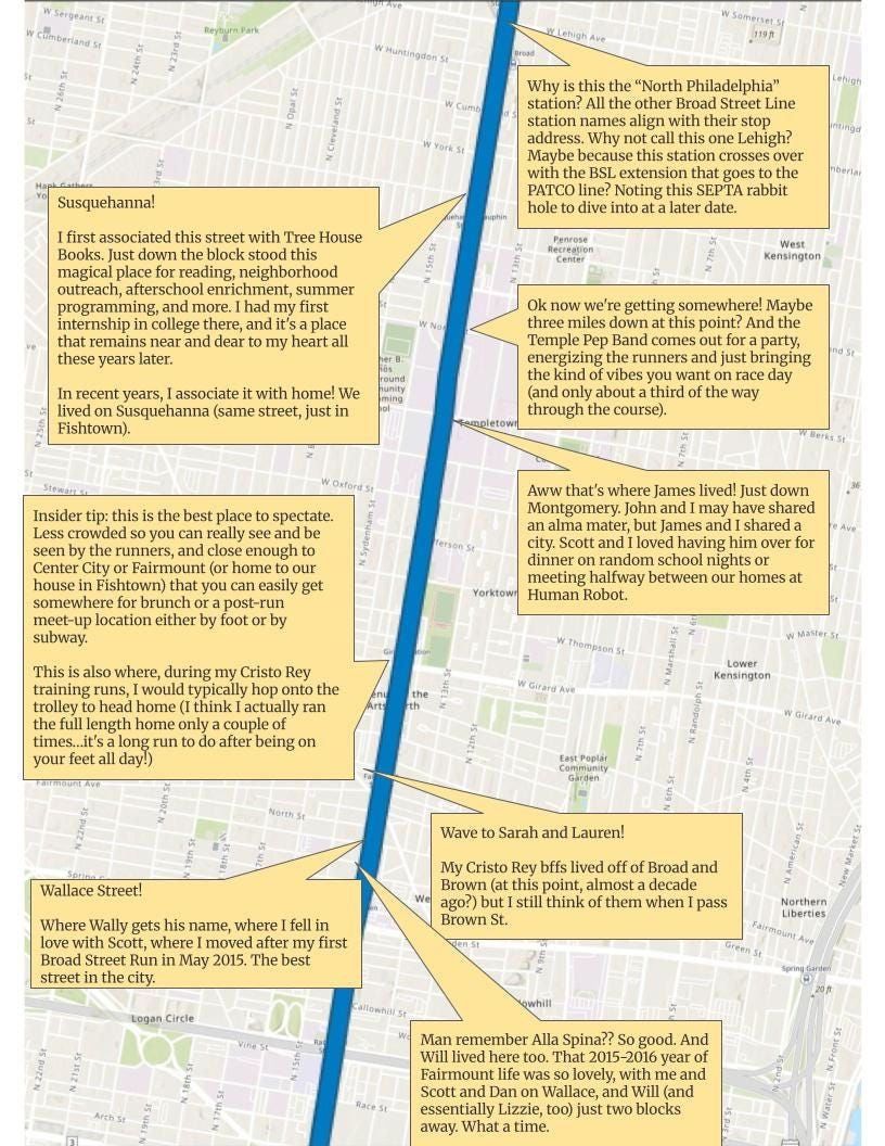
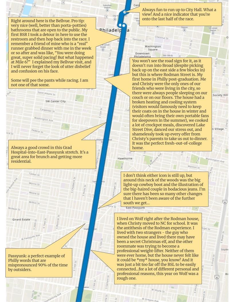
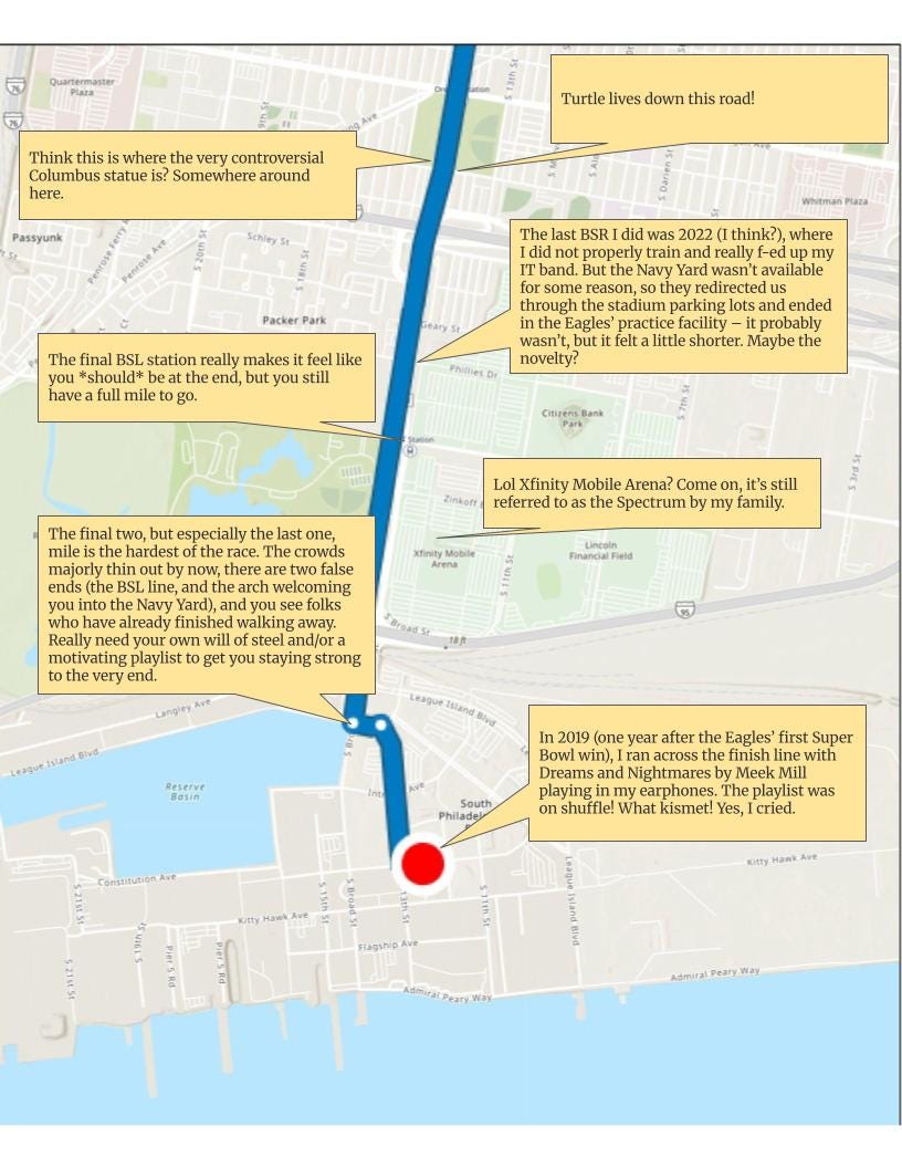
I recognize that it might be hard to imagine what exactly this method looks like in practice. So! The Broad Street Run holds such a special place in my heart, as it does for so many runners, and it’s this Sunday.

So let’s pretend that someone was studying the race-day perceptions of a city through the case of the Broad Street Run in Philadelphia. I’ll be a participant in the study, where they give me a map of the race course with street names and some local identifiers, and I need to describe what I think as I run down Broad Street.
Check out my answers in the images below. It’s my little nostalgic love letter to my favorite city, my home.
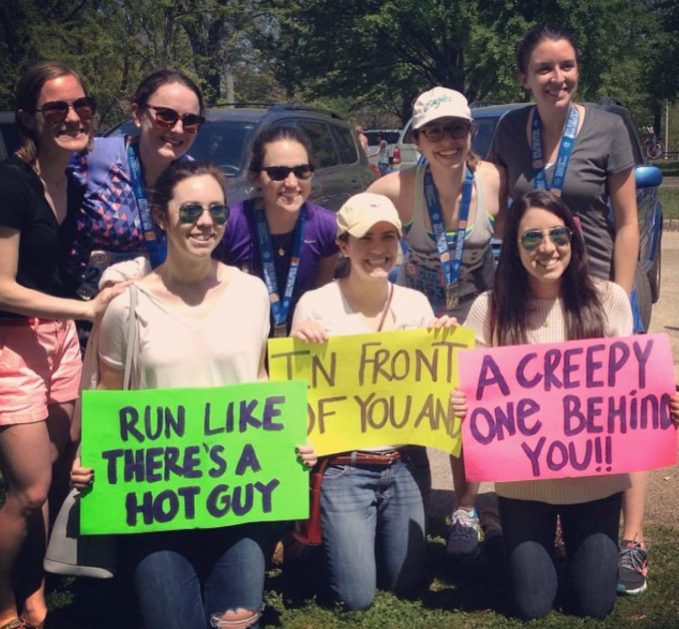
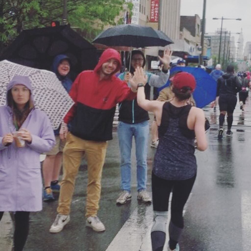
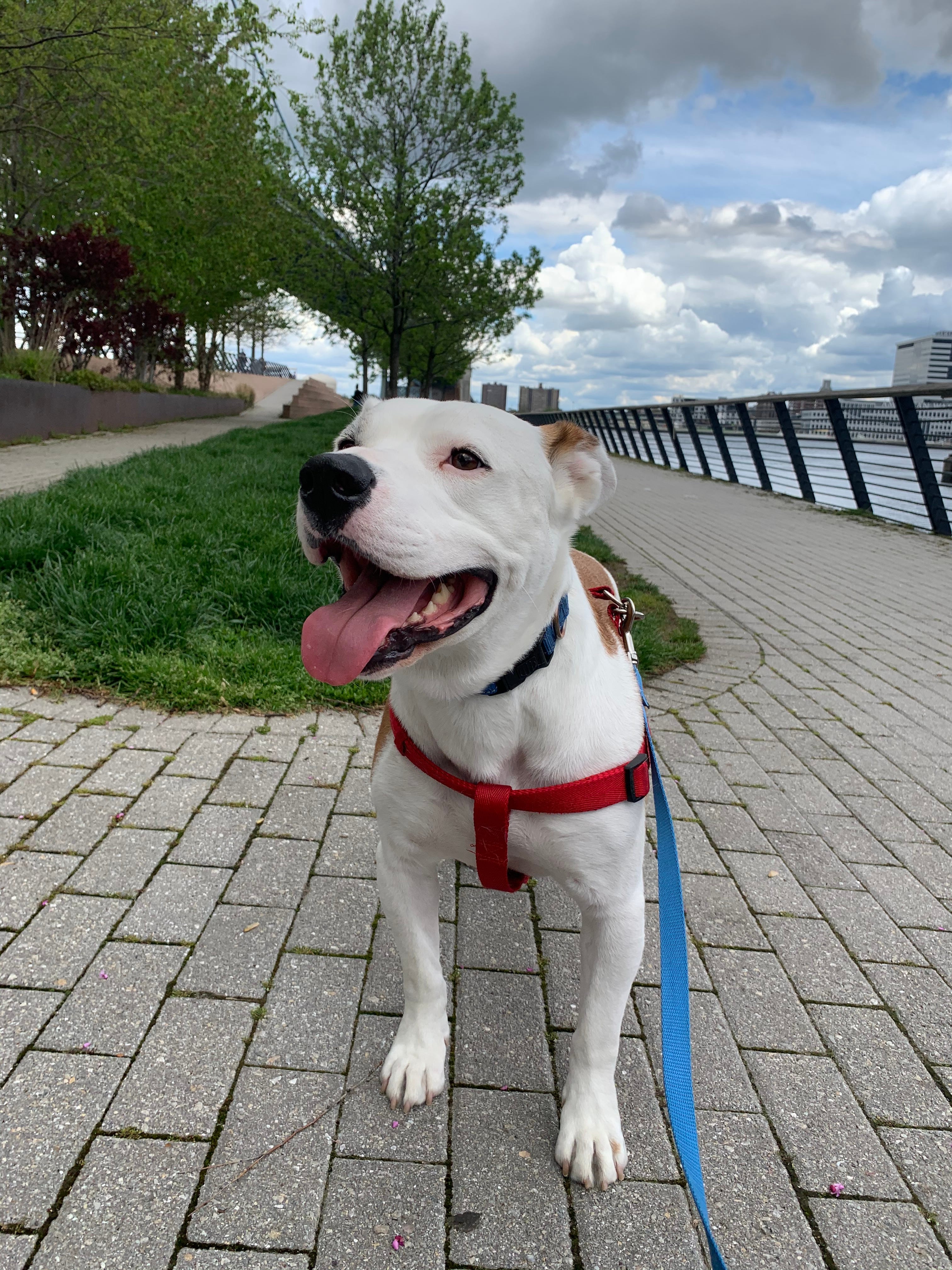
And for good measure, adding some photos of past BSR experiences:

For runners/Philly-area readers: what would your annotated map of the Broad Street Run look like? Describe it in the comments, or message me for a set of the blank maps that you can fill in on your own!
Very cool, Lili! It’s a great weekend in Philadelphia! 🏃🏼♀️🏃